Blogs > Blake's Big Weather Blog

An inside look at chasing severe weather during the height of storm season in Tornado Alley...

Wednesday, June 2, 2010

Better Lucky Than Good?

Monday, May 31st. Memorial Day. A day that started in Missouri and moved to Kansas, Colorado, Oklahoma and finally back into Kansas. A day that began with little promise and ended with epic conditions and an unmatched experience. A day that will stay in my memory for the rest of my life.

6am - Kansas City, Missouri
After meeting with the rest of my chase group on Sunday night and having our first weather brief, we set 7am as our departure time from Kansas City. Our target area would be Southeastern Colorado, clear across the state of Kansas. The Storm Prediction Center had issued a Slight Risk for severe storms with a small area of interest in far SW Colorado, extreme N Texas, NW Oklahoma & SW Kansas. This area was designated with a 2% tornado risk, meaning the chance of a tornado occurring within 50 miles of a given point in that area was 2%. Given the small potential for tornadoes and the distance we needed to cover, the mood wasn't entirely ecstatic. There was a small pocket of optimism which could be chalked up to it being the first day of the tour. And so we found ourselves, a few minutes past 7am, with a full tank of gas, crossing the border into Kansas and heading southwestward towards Wichita.

3pm - Greensburg, Kansas
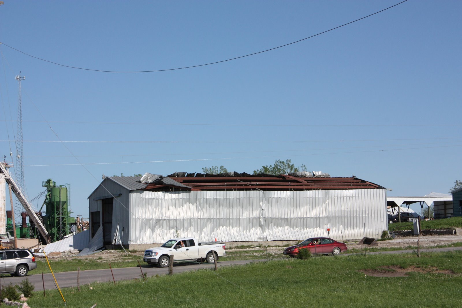
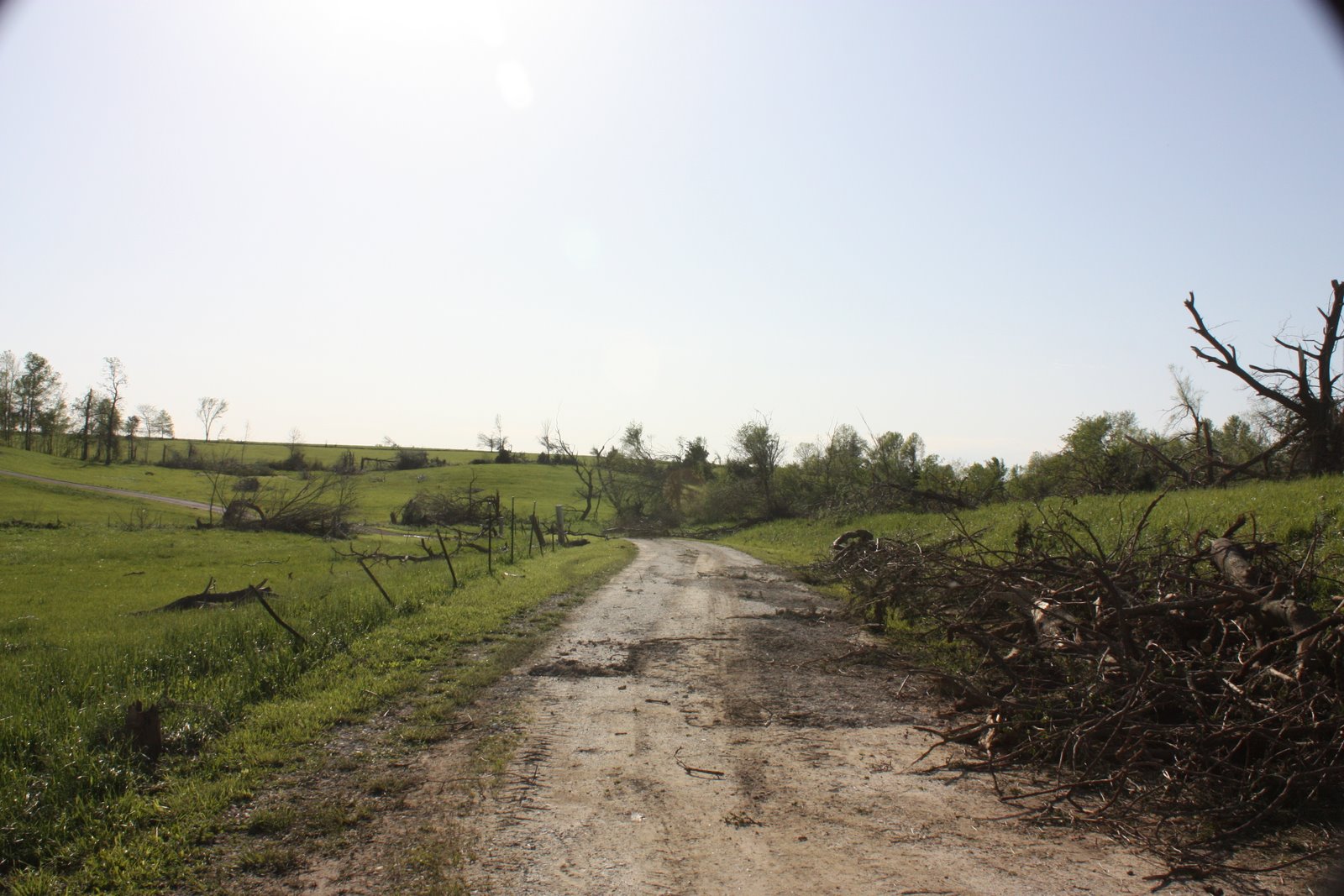
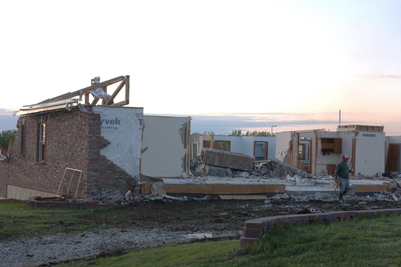
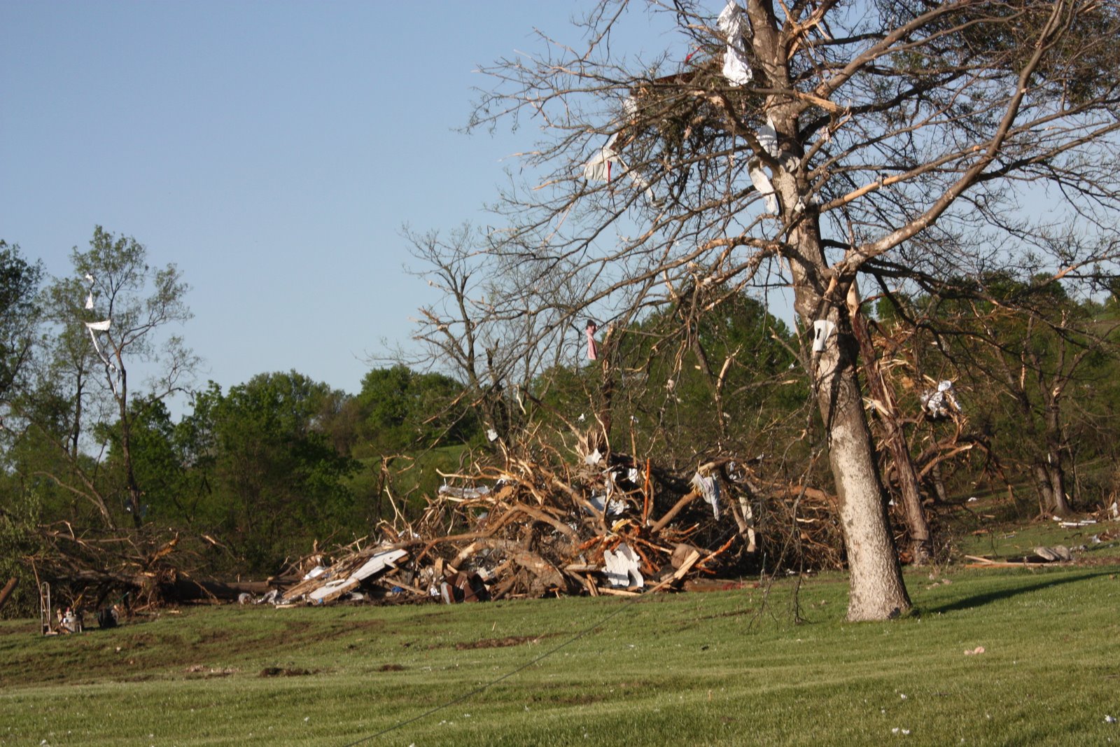
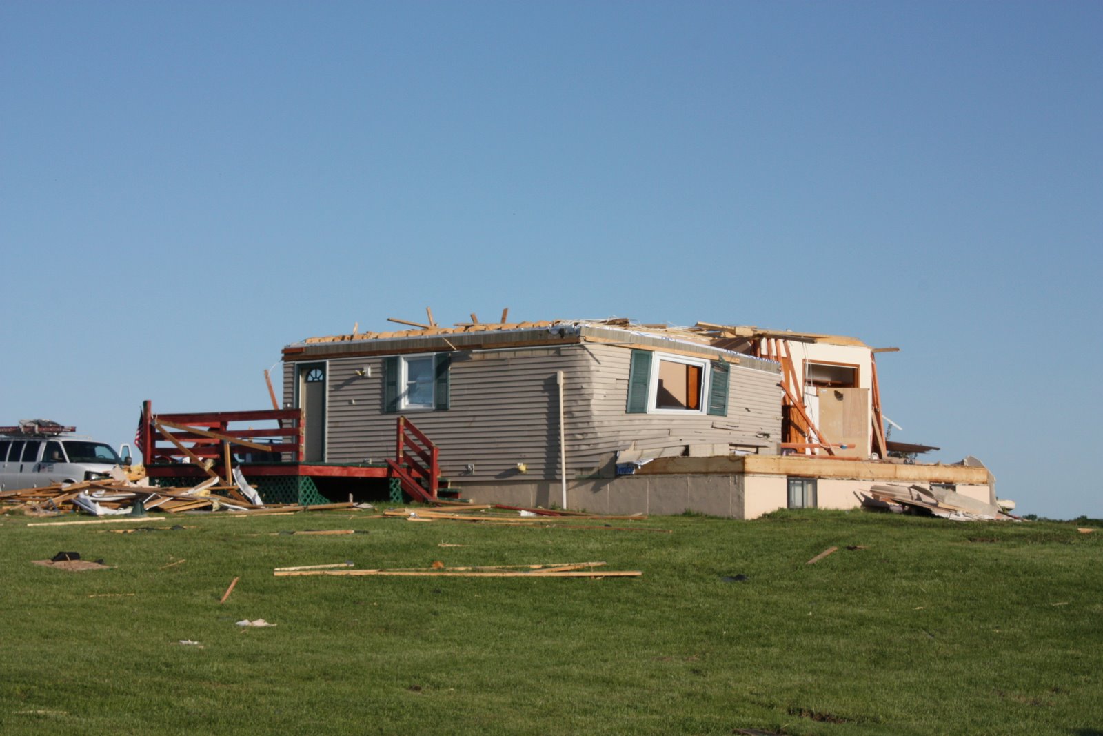
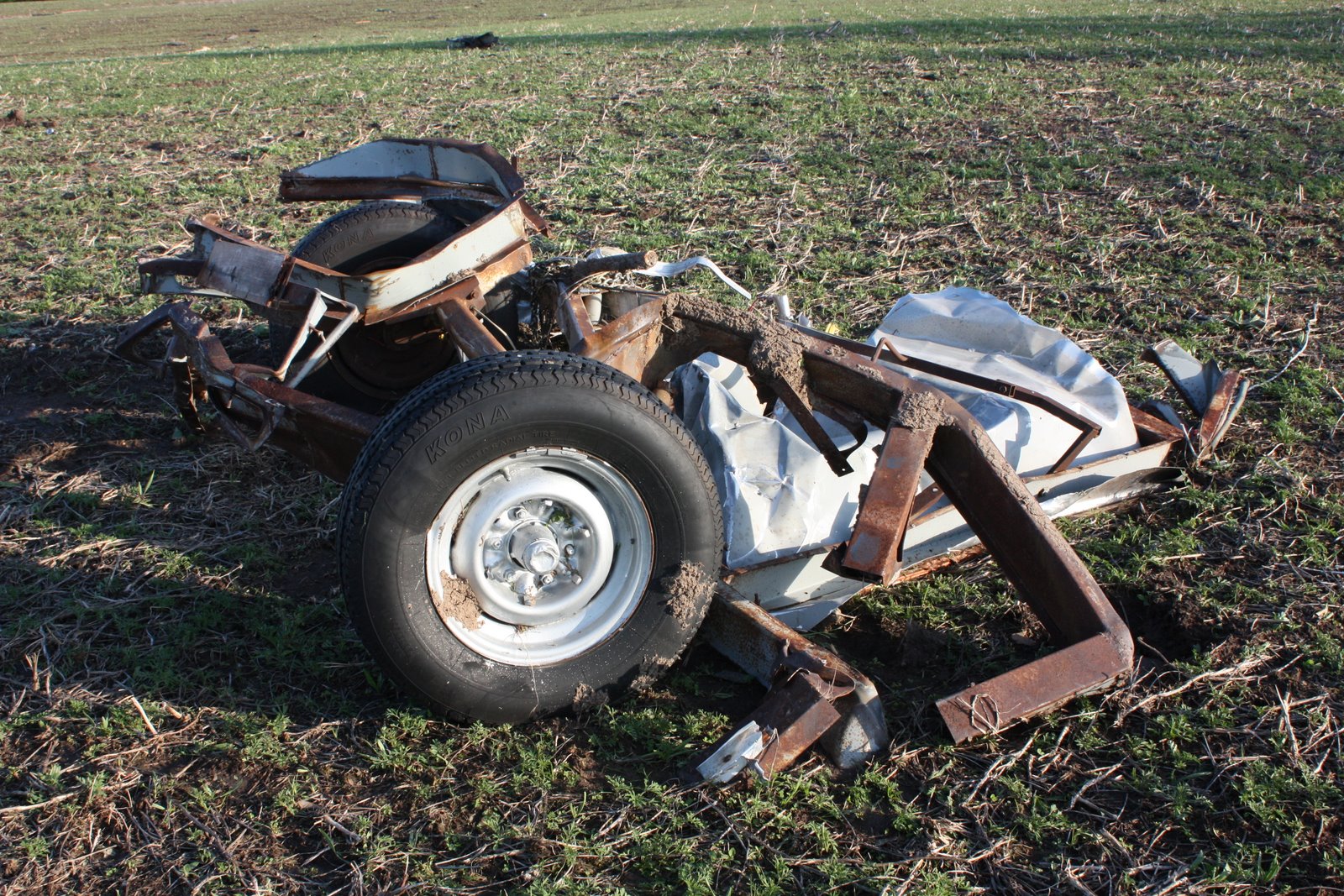
We stopped for foodand gas outside of Wichita and continued west, still with most of Kansas to cross. At around 3pm, we passed through the town of Greensburg, KS, which was devastated by an EF-5 tornado on May 4th, 2007. 95% of the town was leveled and eleven people were killed by the 1.7 mile wide tornado. Since then, the town has taken the opportunity to rebuild using "green" technology, but the scars left by the massive storm are deep and will never fully heal. Passing through, the empty cement slabs and broken, leafless trees were a strong reminder of just how powerful tornadoes can be.

4pm - Dodge City, Kansas
As the afternoon progressed, we stopped in Dodge City for gas and a bathroom/stretching break. We also took advantage of the improved internet signal to take a look at the weather models and current radar. Visible satellite imagery revealed that several storms were firing in our target area of Southwestern Colorado. Things were looking up. And then, things looked even better.

4:03pm - Dodge City, Kansas
In the time it took to use the restroom and buy a souvenir hat, some gum and a soda, the storm in Colorado had begun to drop funnel clouds from its base and was tornado warned based on storm spotter reports. This is an important distinction since storm cells can also be tornado warned if they show certain characteristics on radar, and the potential exists for a tornado to form at any moment in that area. When a cell is warned based on reports by storm spotters or storm chasers, things are actually happening already. There was some bad news. We were currently 155 miles from the base of the storm. As in hours away. This was problematic, since many tornadoes last only minutes, some even seconds. Nevertheless, we all jumped in and headed towards Colorado.

Not long after getting back on the road, we saw the anvil top of our storm. The "anvil" is so named because the cloud has reached the top of the troposphere and cannot rise any further, so it spreads out, like an anvil shape. The anvil for this storm was extremely long and crisp - meaning the storm was powerful and had plenty of energy to continue building. Looking at radar, we noticed something strange. The storm, which was still tornado warned, wasn't moving. It was building, and the clouds inside it were moving, but the storm wasn't advancing eastward or any real direction in particular, it was just staying put and strengthening.

6:00pm-ish - Manter, Kansas
Against all odds, this storm was still tornado warned. For nearly two hours, it had built and strengthened and dropped an occasional funnel from its cloud base. It had not produced a sustained tornado, but as we approached the Colorado border, we could see the pronounced cloud base and vigorous cloud to ground (or CG) lightning. In two hours, the storm had moved less than 20 miles. It seemed like the storm was waiting just for us. This was going to happen!


5:20pm-ish - Springfield, Colorado
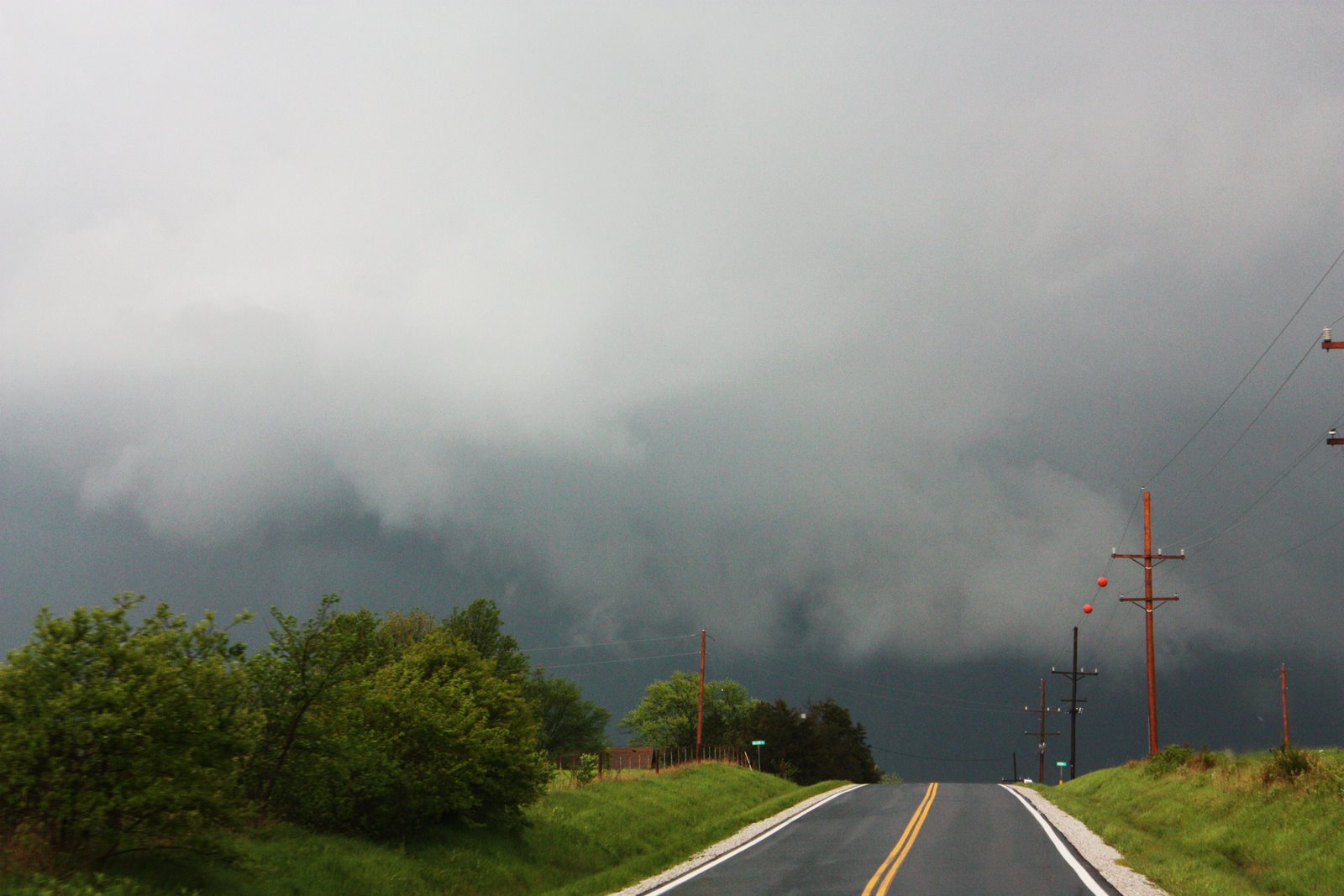
Time seemed to stand still as we closed an incredible distance on a storm that had been under constant tornado warning for over 2 hours now... Having crossed into Mountain Time, it was like we'd been given a bonus for having made it all the way across Kansas. As we reached the town of Campo and headed west on a small dirt road, the scene unfolded directly in front of us. In the rolling fields west of town, we positioned ourselves directly south of the storm. We could see the wall cloud descending from the main cloud base under the storm. This was really going to happen!


6pm-ish - Campo, Colorado
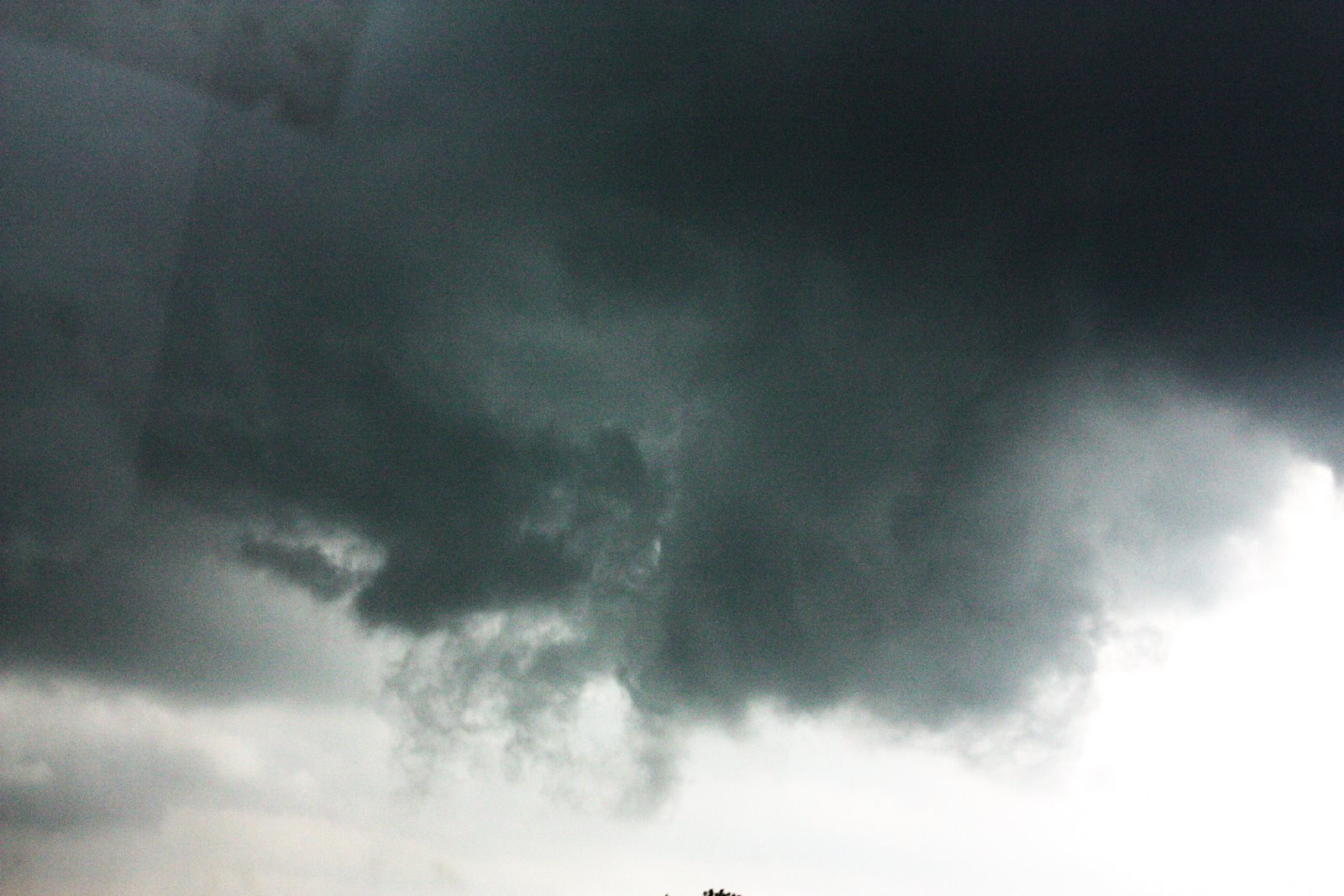
We were in perfect position. The wall cloud was about 1/4 to 1/2 mile to our west-northwest. We watched with incredible clarity and detail the mechanics of tornado-genesis. We watched the rear flank downdraft (RFD) wrap around the back edge of the storm and meet the updraft being sucked up into the clouds above. We saw the rotation tighten and create funnel clouds again and again, trying to create a tornado. Several times the cloud reached almost all the way to the ground, only to be pulled back into the cloud base above.


The motion was intense in the clouds, yet the storm was moving extremely slowly across the ground, meaning we could comfortably stay very close to the action. While my previous tornado intercept was lightning quick, reactive and a bit dangerous, this was completely free of fear, and almost leisurely. A few times, the strongest rotation was just a few hundred yards from us. It was one of most incredible experiences of my life. We kept re-positioning ourselves for the better part of an hour until we ran out of south roads. We watched as the wall cloud finally crossed over our road and into a wide expanse of prairie to our east, between us and the town of Campo.


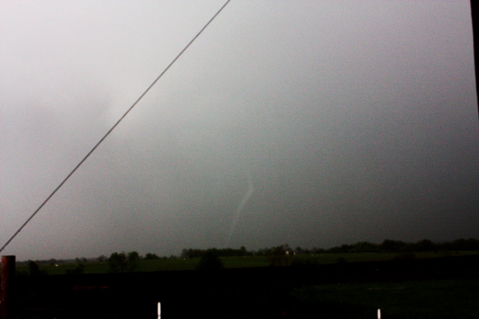
7pm - Campo, Colorado
Almost at the top of the hour, a beautiful white funnel cloud descended from the storm above. This one was different than the ones we'd been watching for the previous hour. This one was more focused, the rotation more precise, the descending motion more intense. This was finally, improbably, magically even, going to happen! With a chorus of cheers, the funnel touched down and became a tornado. Even better, the tornado was extremely photogenic and best yet, it was in a field with minimal structure and property in its path.


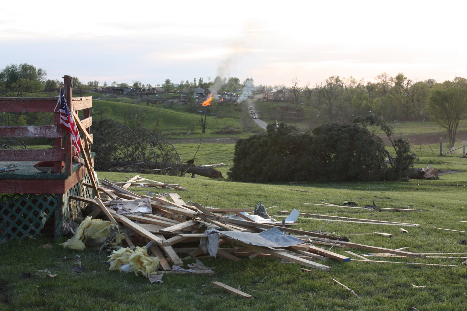
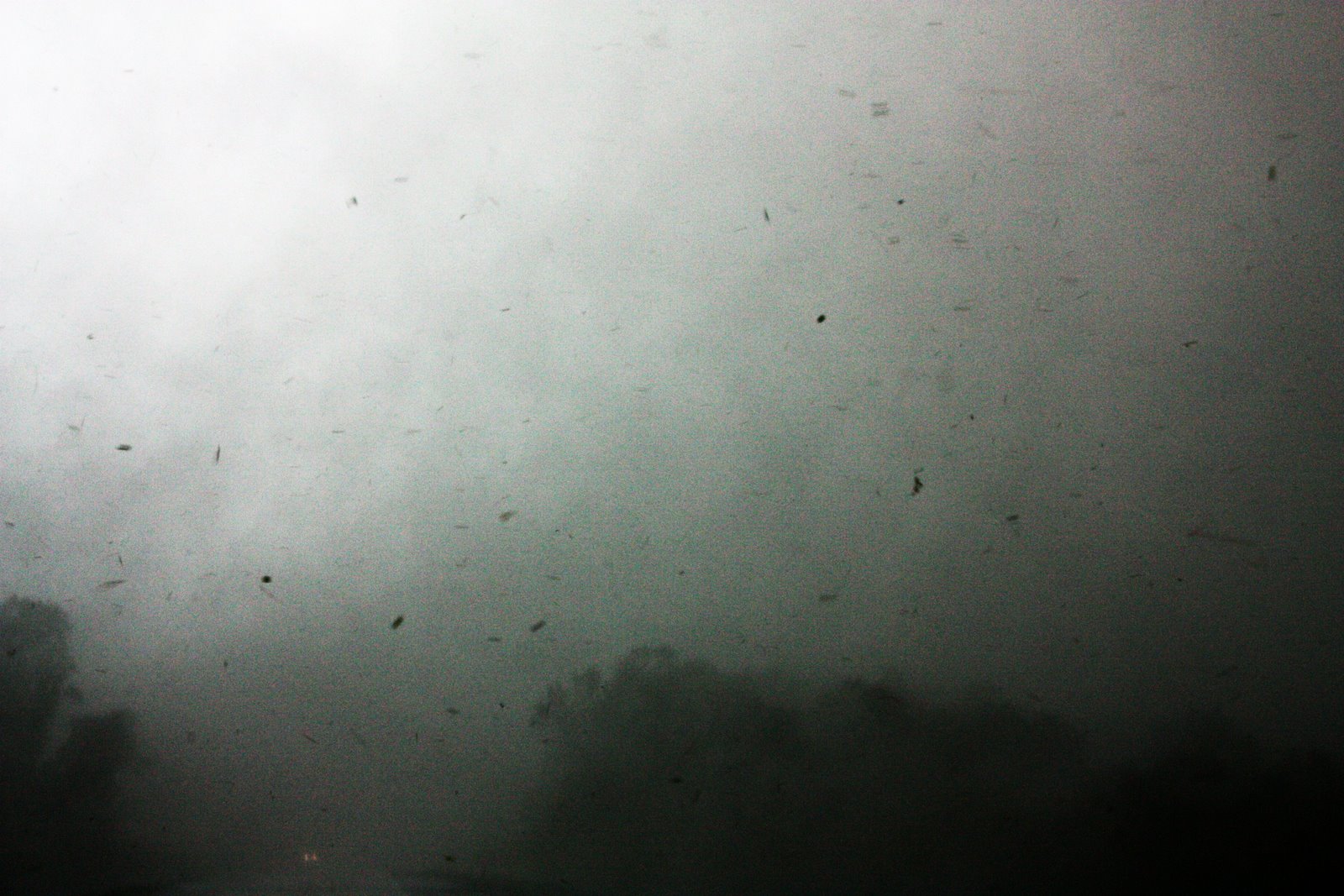
As the tornado intensified, so did the storm and it began to move away from us with increasing speed. We had run out of roads heading south, so we backtracked north and then east into the town of Campo. There was a generous ground cover of 1/2" hail through town and south along the main highway.


Time Unknown - Keyes, Oklahoma
As we drove further on, there were more and more vehicles on the side of the road, and we soon learned why. The first tornado had lifted, but a second powerful tornado had dropped down soon after in its place. We continued to drive south into Oklahoma so we could find an east road that would let us get a close view once again.


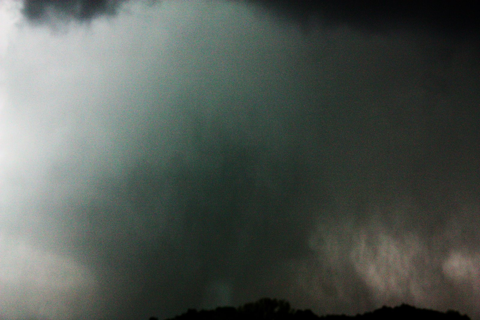
Finally, we closed in on the tornado west of Keyes as it was weakening, watching as it "roped out." We continued to follow the cell eastward, watching as it morphed into a "mothership," a cloud formation named for the unique rounded shape similar to the alien mothership in "Close Encounters of the 3rd Kind." There continued to be ample motion within the storm but it produced no more tornadoes. We had watched the entire life cycle of a tornado, from the descending of a wall cloud, to the formation of funnels, to the initial touchdown and finally to the death.


Talking with veteran storm chaser Tim Samaras later that night, he estimated that the ground speed of the tornadic winds was somewhere near 200mph. He had a pretty good view of it - less than 100 yards from it as it crossed the highway in front of him and some other storm chasers. There was minimal damage from the tornado - only a few power poles had been knocked down - and nobody had been injured. The tornado was particularly photogenic and took place in a beautiful part of the country. From a storm chaser's point of view, it doesn't get much better than the Campo tornado on May 31st, 2010. We had been incredibly lucky, and with the excellent guidance from our tour guides Dave Holder and Olivier "Klipsi" Staiger, we intercepted one of the more photogenic tornadoes of the past few years. Sometimes it's better to be lucky than good, but it's never better than to be lucky and good...

Friday, May 28, 2010

Midwestern Stormchasing - Round 2

Storm over West Chester, May 14th, 2010

A year has passed since I encountered my first tornado in Kirksville, Missouri last May 13th. But, I've found that instead of having quenched my thirst for seeing a tornado, I've developed a seemingly insatiable hunger for observing severe storms. What was a growing hobby a year ago has blossomed into a full-time passion, weather enthusiast has become a full-blown weather nut.

My friends and family have been largely supportive, if somewhat confused, by this new direction in my life. Even when I'm unbearable and rambling and ranting and raving about how amazing that inconsequential cloud off in the distance is, they've been okay with it (at least to my face). Which is nice, and mutually beneficial as well, since now I've become their new favorite source of personal weathercasts... And while an episode of "Storm Stories" on The Weather Channel and a front page spread in my own Daily Local News have lent an air of credibility to my opinions, I'm still just an amateur weather geek, not an actual, degree-holding meteorologist.

Having been away from the massive storms in the Midwest, I've been forced to subsist on the "scraps" tossed to us East Coast weather peasants... The mere hint of a cumulus tower going up has quickened my pulse, and yet time and again, the storms have let me down, often dying just west of me with a rather punitive regularity. But a funny thing happened through all these failed storms - I've grown an appreciation for minute details in the skies overhead. There are brief, fleeting moments where a few layers of cloud might separate briefly and reveal breathtaking cloudscapes behind the curtains of rain and condensation, and I've been lucky to be in exactly the right place at precisely the right time... It's as if, with sympathy, the weather gods have sent me my own consolation prize.

This new perspective and appreciation has, if you will, allowed me to weather the proverbial storm (or lack thereof) and until the past month, I've managed my want for storms through the live internet streams and Facebook photo postings of fellow chasers I've befriended over the previous twelve months. But now, on the eve of my long overdue return to the American Plains, nothing can calm the growing fire inside. My days of chasing vicariously are over (for the next two weeks), soon to be replaced by the next chapter of my storm chasing adventures in Tornado Alley. So check back for updates and photos of my time in search of Big Weather...

Storm approaching West Chester, May 27th, 2010

Wednesday, May 20, 2009

The Kirksville Tornado

Tornadoes cannot currently be measured by the speed of their winds. This is partly because it's difficult to fabricate a measuring device than can withstand the severe wind and debris damage caused by tornadoes, and party because it's even more difficult to get those wind instruments in the path of a tornado. Therefore, the strength of a tornado is instead measured by surveying the damage and comparing it to known damage at a controlled speed. For instance, if tests reveal that it takes winds of 136 mph to strip the bark off a tree, and the damage from an actual tornado shows trees with their bark stripped, the tornado could be classified EF3

This damage scale, known as the Enhanced Fujita scale, was instituted February 1, 2007. It replaced the original Fujita scale, but basically remains the same with one main change. The Enhanced Fujita scale takes into consideration differences in building quality and the strength of structures that deteriorate over time.

Here is a simplified Enhanced Fujita scale:

EF0 - Winds 65-85 mph - Light Damage - some damage to roof & siding surfaces, branches broken, trees pushed over.

EF1 - Winds 86-110 mph - Moderate Damage - roofs severely damaged, mobile homes overturned or severely damaged, windows & doors broken.

EF2 - Winds 111-135 mph - Considerable Damage - roofs destroyed, mobile homes completely destroyed, foundations shifted, large trees uprooted or snapped, light objects become missiles, cars lifted.

EF3 - Winds 136-165 mph - Severe Damage - entire stories of well-built homes destroyed, severe damage to large buildings, trees debarked, trains overturned, heavy cars lifted.

EF4 - Winds 166-200 mph - Devastating Damage - well-built houses completely leveled, objects become missiles, cars thrown.

EF5 - Winds 200 mph+ - Total Destruction - large neighborhoods destroyed, landmarks rendered unrecognizable.

The last F5 tornado was May 3, 1999 in Moore, a suburb of Oklahoma City. The first EF5 tornado occurred eight years later, in Greensburg, Kansas on May 4, 2007 and destroyed the entire town. The most recent occurred in Parkersburg, Iowa on May 28, 2008, and destroyed half the town.

When the National Weather Service conducted its initial damage survey of the Kirksville tornado, they rated it an EF2. They have since re-rated it an EF3. On May 14th, we conducted our own damage survey. This is what we found:


At around 6pm local time, the tornado touched down several miles west of Kirksville, MO. The tornado continued on a ENE path, crossing Rt. 6 west of Kirksville just a few hundred yards in front of us, strengthening, and forming a wedge-shape. The tornado crossed several large fields, changed its direction to due East and began destroying structures on the western edge of Kirksville, near the intersection of State Hwy. B & Brewington Ave. The damage in this area was rated at EF1.


The tornado then crossed Rt. 63 on the Northern edge of Kirksville, killing two people, flipping cars at a dealership, and causing significant damage to structures in the area. At this point, the tornado resembled a cone shape, and the damage was rated at EF2. After crossing Rt. 63, the tornado kept its cone shape and began heading ESE. The tornado crossed several fields and tree lines along State Hwy. P, causing tree damage and moderate damage to structures before crossing St. Hwy. P just South of Clearwater Way.


The tornado strengthened again, and was now carrying debris large distances, causing severe damage to trees and structures as it approached Dairy Way. The tornado was now snapping and debarking trees, snapping power and telephone poles, flipping sheds, throwing missiles, and completely destroying small structures such as silos and small barns. The tornado continued to strengthen and bear ESE, killing livestock along Steer Creek Way.


The tornado then reached its strongest point, causing very strong EF3 damage as it completely removed the upper levels of a new brick house, destroying and tossing farm equipment, snapping whole trees in half, killing livestock, generating large missiles, and crossing ESE over Steer Creek Way.


It completely destroyed another house, completely removing its roof and carrying it for almost a mile, snapped large pines and hardwood trees, stripping bark, removing large branches, sending 2x4 missiles through automobiles and exterior walls of houses, removing entire structures and carrying them aloft for more than 1/2 mile, throwing large farm equipment, ripping heavy welding, dragging large trucks several hundred yards, and pulling posts from the ground.


A possible satellite tornado or extended suction vortex may have formed North of the main funnel and lifted a barn roof, carrying it before throwing it into a tree. The tornado, now South of Steer Creek Way, began to weaken, but still causing considerable damage to trees and smaller structures, and carrying large debris large distances and over 100 ft. in height. It crossed a field just West of State Hwy. 11, still in a cone shape, breaking trees, flattening road signs, snapping power poles, and pulling fences from the ground and carrying them, and missed a farmhouse between Steer Creek Way and J Point RL. After crossing State Hwy. 11 just North of us, the tornado "roped-out" and dissipated after a few minutes. A larger, more powerful tornado then formed East of there, but struck a less-populated area.


The results of our damage survey were astonishing - we had twice been less than 200 yards from a very strong, very large EF3 tornado. The Kirksville tornado had the power to snap thick trees, twist steel, carry large objects through the air for miles, and topple brick walls. Had the tornado passed a mile or so to the South, through downtown Kirksville, the results would have been devastating. Through detailed damage surveys like ours, and by comparing our results with steadily improving radar & satellite data, scientists and engineers will be able to better understand the forces at work in tornadoes, and make warnings earlier, structures stronger, and lives easier to protect...

Thursday, May 14, 2009

That Close...

Heading West on Rt. 6 out of Kirksville, Missouri, I saw my first tornado. Nothing I've ever seen could have prepared me for what I witnessed Wednesday. Nothing will ever erase my memories of that day. I've seen at least one funnel cloud in the skies over Chester County, but it didn't come close to what was occurring in front of my eyes. A few hundred yards ahead of me, a large tornado mowed through the roadside trees and crossed into the road.


Minutes earlier, the storm had claimed its first victim, a woman whose mobile home was picked up into the air and thrown by the tornado. The air was dense with debris as it crossed Rt. 6 just West of our van, filled with the remnants of structures and trees. Our guide and driver, Meteorologist Matt Van Every, put the van in reverse and began backing away from the circulating mass of rain and shrapnel. Still, the tornado closed on us - it seemed for a few moments that we would be sucked into the vortex. However, Matt assured us that while the wind was howling around us, we were far enough from the inflow (the air being sucked into the tornado) to be safe. He was right. The tornado crossed the road at an angle - so while it appeared to be coming straight for us, it was actually moving into the field adjacent to us.


Our perception of time and distance, I have come to find, are significantly skewed during moments of intense stress. Our first intercept of the Kirksville Tornado seemed to last an eternity and yet only seconds at the same time. I did say first intercept, because our experience with this deadly tornado weren't over yet.


As soon as it was safe, Matt turned the van around and headed back towards Kirksville. The tornado was now chewing through fields to our left, running parallel to us. It intersected electrical lines and several power flashes glowed bright blue over the treetops. Waiting for the tornado in a position to our North was Reed Timmer in the armored SRV. They were able to witness the tornado before it crossed the main road (Rt. 63) that runs North-South through Kirksville. After it moved East of the SRV, it claimed two more victims and collided with a car dealership, flipping many of the vehicles over, and causing extensive damage to homes and businesses there.


As the tornado continued to move East, so did we. We lost sight of the tornado for a few minutes, but found another wall cloud forming directly ahead of us. Based on the radar and visual observations, Matt said the tornado that it would produce would be very large and powerful. As we continued East on Rt. 11, the road curved 90 degrees to the left several miles from downtown Kirksville (many roads in the Midwest are like this - with only a sequence of 90 degree turns instead of a diagonal route, following the outlines of properties and farms). We could see dark clouds ahead and to our left, and the growing wall cloud to our right. As we crested a hill, Matt got a clear look at the dark cloud to the left and realized that it wasn't rain or hail, but a tornado!


There were two vehicles ahead of us, including one driven by Tim Samaras, a well-respected storm chaser who has been featured by National Geographic. They saw the tornado at almost the same time we did, but they were further up the road, just feet from the oncoming tornado on the crest of the hill. Both trucks were able to turn around in a driveway with only seconds to spare. Had we tried the same maneuver, we would have been hit by the tornado. Instead, we began backing up quickly, but found our exit blocked by other vehicles. As we tried to continue backing up, the trucks ahead of us finished turning around and passed us speeding in the opposite direction, followed by a third truck coming from that direction. This truck, which held a family whose house sat just up the road, was trying to flee the area, but had found its path blocked by the turning vehicles, and was forced to wait directly in the tornado's path as they cleared the road. They were probably less than 150 feet from the tornado as it howled up through a field towards them.


In the air was more debris than we had seen before, and was much larger in size. There were rooftops, large metal sheeting from grain silos, barns, lumber, mangled farm equipment, trees... The sound was deafening. Many people say tornadoes sound like a freight train. I always wondered whether they meant the sound of the train rumbling past or the sound of the train's horn or whistle. I thought it sounded more like a large waterfall, just constant loud rushing, but with a bass note that made the air seem to tremble.


The tornado dwarfed the white farmhouse that stood among some trees on the crest of the hill in front of us. It looked like the tornado would completely destroy it right before our eyes. Luckily, the tornado was about 50 feet North of the house, and spared it, but flattened a road sign just up the road to the ground. It pulled a barbed wire fence, posts and all, straight out from the ground and dragged it across the road. It snapped telephone poles in half like they were matchsticks. But the house stood.


Meanwhile, we were watching the scene unfold directly in front of us, all the time trying to move back, more from the falling debris than the tornado itself. The tornado passed about 150 feet from where we had stopped, but the debris swirling around it was well over our heads and falling all around us, even behind us. This debris cloud racing around the tornado made it appear to be 2 or 3 times larger than it was, although the velocity of the winds was very apparent and very real. As I sat in the front seat of the van, the inflow was sucking all the air, rain and debris around us towards it, but our van held steady. Almost immediately after crossing the road, the tornado lost its strength and dissipated (called roping-out, for the rope-like shape it takes while dying). We drove forward, but found our path blocked by the barbed wire fence, so we turned around, and took pictures of the tornado dying to our East and the damage around us. After that, we decided that we were done chasing for the day and headed back towards downtown Kirksville.


Only a handful of people in the world have voluntarily done what we accomplished that day - getting within 100 yards of a large and powerful tornado. Not only did we intercept an F3 tornado, but we did it twice, about 8 miles apart. When we headed back to Kirksville, we didn't know the extent of the damage. We didn't know that three people had been killed. We didn't know that homes had been completely destroyed. We didn't know what path the tornadoes had taken. We didn't know that the tornadoes we saw on either side of Kirksville were actually the same one tornado, just eight miles apart.

The following link shows the sequence after we have seen the tornado for the first time, and after we have crossed back across town toward the newly-forming wall cloud:

http://www.youtube.com/watch?v=0uP0eDDag5A

When we drove back into Kirksville, we found most of the town intact. It was quickly getting dark, and access to the Northern part of town was blocked off by emergency personnel. We would return the following day to do a damage survey, and hopefully better understand the sequence of events that left a community forever changed.

Check back this weekend for the results of the damage survey and some of the survey photos.

(Note: the National Weather Service has already completed their damage survey, but with evidence that we collected during the event, and during our own damage survey, we strongly disagree with their rating of EF1-EF2 damage. Our assessment showed strong EF3 damage and evidence of winds approaching and possibly exceeding known windspeeds in the EF4 range. Also note that the EF (Enhanced Fujita) rating is based on surveyed damage and not recorded windspeeds, since there is currently no way* to measure these winds.)

Labels: , , , , ,

How Close Is Too Close?

When I signed up for this trip, there were no guarantees offered that I would actually see a tornado. In my mind, the probability rested somewhere around a 25% chance. Since Monday, models have shown that May 13th would be the most favorable day for severe weather during my trip, and ultimately for me to see a tornado. Yet when I woke up Wednesday morning at 5:20 AM, I was losing hope. Models were still calling for the severe weather, but the probable area was now much larger, from Northern Illinois southwesterly through Lower Oklahoma. This meant that it would be much more difficult to pinpoint exactly where the bad weather would happen, and when.

Before we go further (an you'll want to, trust me) I think a brief science lesson would be a good idea...

Supercells are a specific type of thunderstorm. (All supercells are thunderstorms, but not all thunderstorms are supercells.) Many of the thunderstorms on the East Coast occur as a cluster of cells arranged in a line, which move in a more linear (duh), organized pattern, with little or no rotation within the storm. Supercell thunderstorms are isolated, and occur outside of these squall lines.

There are a few ingredients needed in order to produce supercell thunderstorms:

1. Available energy (CAPE, or Convective Available Potential Energy). This is an overly complicated way to describe warm, moist air rising, like you might feel rising off the ground on hot, sunny days, except on a much larger scale.

2. Atmospheric instability. This is an overly complicated way to describe a layer (or layers) of air that will allow the rising air to easily pass through it on its way skyward. When there is stable layer of air, it's difficult for rising air to find a way through. This is called a cap, because it basically puts a lid (or cap) on the rising air and doesn't allow it to find the cooler air that will condense it. (Think of it this way: try pushing your finger through some uncooked spaghetti. This is like stable air - it won't allow your finger to go through. Cooked spaghetti would be like unstable air - it would easily move aside & let your finger slide through).

3. Vertical shear. This is an overly complicated way to describe high, strong winds pushing clouds in a different direction than they want to go (think of the wind pushing your car sideways on the highway during a windy day - your car wants to go straight, the wind wants it to go sideways).

4. Storm rotation. This means that as the air rises through the atmosphere, the winds pushing it rotate in a clockwise direction the higher in the storm they are (think of a spiral staircase).

So what happens when you combine these ingredients? As warm air rises through the atmosphere, it cools, and condenses into droplets of water (also known as rain or hail) which fall back to earth. In a regular thunderstorm, the precipitation (rain or hail) falls back into the storm, neutralizing the effect of that warm air rising, and allowing the storm to collapse in on itself. In a supercell, the saturated, warm air rises quickly through the unstable air, so it keeps more of that upward energy behind it, and reaches those crosswinds. This pushes the top of the growing supercell ahead of its base (If you were watching a textbook supercell pass from left to right in front of you, it would roughly be aligned like this: // . This allows the precipitation to fall ahead of the storm, instead of back into it, and the energy basically explodes inside the storm, forcing the air upwards until it can't go any higher and the top spreads out in the anvil shape that's common with supercells. When all of this begins rotating, it is the perfect scenario for a tornado to form.

But throughout the morning and early afternoon, this wasn't happening. We left Kansas City around 6:15 and headed for a target area halfway between Springfield, IL and St. Louis, MO. The entire sky was overcast, and remained so throughout most of the morning, which was inhibiting the development of supercells, because the sun couldn't get to the ground to heat it up. In addition, there was a layer of stable air, which was also preventing that warm, moist air from rising. The glass was beginning to look half empty. When we neared our destination around 1 PM and the models began to change, it meant we'd have to backtrack over 100 miles towards Kansas City, and things were looking downright bleak.

We stopped in Wentzville, MO to look things over & meet up with Reed Timmer and his entourage. We'd be chasing together for the rest of the day. Timmer is the evil genius behind TornadoVideos.net (TVN) and ExtremeTornadoTours.com (ETT), which is the tour I'm on. He was featured during the past season of "Storm Chasers" on The Discovery Channel, and chances are if you watch footage of tornadoes, he was behind the camera (or next to it) for a lot of what you've seen. He's got a certain bad boy reputation among chasers, but he added a PhD after his name recently, so you have to at least respect his knowledge, if not his methods. The rest of his entourage included Chris Chittick, the man behind the scenes for TVN & ETT, a certain unnamed radar specialist from Mississippi who just recently helped the TVN team add a whole arsenal of cutting edge technology to their chase vehicle (known as the SRV or Storm Research Vehicle), and the Discovery Channel camera crew assigned to them (a brave assortment of extreme videographers).
The SRV, by the way, is an armored chase vehicle not to be confused with the TIV from "Storm Chasers", which is easy since it's painted red as opposed to the gray TIV. As we waited in Wentzville for the storms to develop, the whole caravan attracted a lot of attention. Not surprising, considering one of the vehicles was a red tank. The people who came to have a look were from all walks of life - a cadre of law enforcement officials, firefighters, handymen, children, even a woman returning home from surgery. Everybody wanted to have a look, and Reed was happy to show off the SRV to all comers, especially the hydraulic system. This system allows the SRV to drop all the way to the ground, which combined with rubber skirting around the entire base of the vehicle, will (supposedly) prevent wind from getting underneath the truck and tossing it into the air.

Meanwhile, the sky began to clear, thanks to a large storm that formed to our South and sucked all of the moisture out from Central Missouri. If it weren't for this cell, that moisture would have been drawn into the larger low-pressure system we ended up following and initiated a large-scale severe weather outbreak (one of the largest of the year) that would have spawned dozens of tornadoes and put many more lives at risk. At 2:40, the Storm Prediction Center (SPC) in Norman, OK issued their first tornado watch, covering Northern Missouri & Southern Iowa. By 3:00, the SPC had issued a second tornado watch, this one covering all of Southern Illinois. Things were beginning to happen, but we had to make a decision - which way to go? The first option was the Southern Illinois area, but since the chase terrain was hilly, it wasn't ideal for staying close to the storms. We decided we needed to get North to follow the contour of the low-pressure system, along which supercells were now trying to form out of Kansas, heading northeastward for Upper Missouri and Iowa.

As we drove North, we had one eye on the mobile radar, one eye on the sky, and one eye on the road (apparently we'd picked up a cyclops somewhere along the route). At around 4:00, as we reached the town of Macon, it started happening. The supercells had pushed their way through the cap and were exploding higher than 50,000 feet into the atmosphere. With the smallest window for error, the caravan quickly refuelled at the nearest gas station and used the facilities with a NASCAR-like precision, then jumped back into the chase vehicles, and sped (I mean serious movement here) North to cut off the supercells near Kirksville, Missouri, 35 miles to the North.

Then, the announcement we'd been waiting all day for: Tornado Warnings! First one, then another, then another... All in quick succession, and each more intense and more serious than the last. "Trained storm spotters report funnel cloud." "Tornado reported on the ground." "Large tornado reported." The view out the driver's side windows told the tale - a massive anvil cloud stretched out over most of the sky, high above dark clouds that reached for the ground. Matt Van Every, our guide and driver, turned on the four-way flashers and activated the rear light bar. "Get your game faces on." As we reached downtown Kirksville, the cell directly to our left dropped a wall cloud from its base (a good sign that a funnel cloud is about to form) and we looked to go West toward the quickly developing storm.

Heading West on Rt. 6, the sky darkened drastically. The wind increased. Leaves began to swirl in the air. The radar showed rapid rotation. The rain pummeled the roof over our heads. Matt slowed the van to a crawl, and pulled to the right shoulder.

And then a very strange thing happened. The wind abruptly, and violently, changed direction, so that everything around us - leaves, grass, rain, standing water, began to disappear into the trees ahead of us and to the left. Then we noticed that it wasn't just leaves swirling in the air - it was pieces of wood, sheet metal, shingles, insulation... As we crept along the shoulder we rounded a bend, and before us roared the most devastating thing I'd ever laid eyes on. I saw in front of me a roiling mass of debris, rotating at incredible speeds around a dark gray, wedge-shaped blur and now emerging back towards us through the trees. A hundred yards ahead, finally, after a lifetime of dreams and nightmares about this exact moment, I saw a monster tornado erupting towards me.

What happened next is a chapter unto itself, and I'll continue from here in tomorrow's blog.

Tuesday, May 12, 2009

The Kansas City Shuffle

Bud Light claims it's all about drinkability. Verizon Wireless boasts reliability. For storm chasers, however, it's adaptability that's the key.

Monday evening's weather models showed slight potential in two places: Northwestern Nebraska and the general area of the Texas Panhandle and Southwestern Oklahoma. These two areas were roughly 650 miles each from where we were currently sitting huddled around the computer. The bigger problem, however, was that each of these areas were at least 830 miles from where we wanted to be on Wednesday, which happened to be Central Illinois. (As a point of reference, it's 838 miles from West Chester to Jacksonville, Florida). And we definitely wanted to be there on Wednesday, because The Storm Prediction Center had issued a Moderate Risk Outlook for that area, and a larger Slight Risk Outlook area extending from most of Wisconsin & Michigan Southwest through almost all of Oklahoma. Big weather, it appeared, was imminent.

Sadly, we decided to sacrifice the day's chase for the prospect of better chasing the following day. We did, however, go to the National Frontier Trails Museum in Independence, MO. The museum is dedicated to the journey west, across the prairies, over the mountains, through the desert, and to the coast, in search of the early American dream. The museum features films, displays, authentic artifacts, maps, and other information that shows just how difficult the journey was, and about who these brave souls were. Independence, by the way, was the starting point for the famous Oregon Trail, and I'm happy to report that since leaving, no one on our tour has died from dysentery.

Afterword, we stopped for some authentic Kansas City food at Smokin' Guns BBQ. Just in case we weren't convinced the pork & beef sandwiches weren't delicious (which they were), the 4-foot trophies, plaques, and 1st place ribbons that literally covered the walls floor to ceiling, front to back strengthened its claim as Kansas City's best. While we stopped, we had a chance to check the latest models and radar. Thunderstorms that had formed in Oklahoma early in the afternoon had begun dropping hail up to 2" in diameter across parts of Oklahoma and Kansas, so we decided to head in that direction. However, after driving into Kansas, the storms moving towards us became disorganized and dissipated above our heads.

After turning around, disappointed, we stopped to deal with some of the technical difficulties back in Kansas City. We would need the technical (a.k.a. laptop w/ mobile internet & GPS) to be without the difficulties tomorrow as we chased down the weather. When we stopped to fix the laptop, we had more technical difficulties, this time with the van, whose electronic locks had shorted and were locking and unlocking at will and with no apparent rhyme or reason. That was easy to fix in relation to the laptop, though, and simply involved removing the proper fuse from under the van's dashboard. After dinner and another trip to the computer store, we headed back to the hotel to get some rest.

At last glance, the models were showing even more favorable conditions for a significant severe weather outbreak on Wednesday, including tornadoes, near Springfield, Illinois. Roll-out is around 6AM, so a little sleep is in order. With any luck, we just might see some tornadoes tomorrow...

Monday, May 11, 2009

What, am I crazy or something?

The world is a small place. There are three guests on this trip, and one guide. Three of us have spent significant time living in Chester County. Our guide lived in Thorndale for several years, and another one of the guests was a Coatesville resident for a number of years. I've been a West Chester resident since day one. This in itself is quite surprising, yet it's not the full story. The last trip I took was to Glacier National Park, in Northwestern Montana. While riding the park shuttle, it became evident that three out of the four groups of people on the shuttle were or had ad one time been West Chester residents. For all the land in this country of ours, it seems that my hometown is well represented.

The common bond between all of us, aside from being travelers, is the desire to witness the extraordinary in nature, to experience the sublime. To get close to nature in its rawest, most powerful form. From walking among mountains and glaciers, to close encounters with wildlife, to standing beneath towering thunderstorms, it's the same goal - to change one's life perspective through experience.

So, what am I doing in Kansas City, Missouri, 1,000 miles from anywhere else I've ever been, getting ready to voluntarily put myself in the path of one of the most powerful forces on earth? (The energy released by an average thunderstorm is roughly the same as a 20-kiloton nuclear warhead.) The answer for many of my friends and colleagues was to finally provide concrete proof that I've got a screw (or two) loose upstairs. The answer for me was getting ready to witness the awesome power and complexity of nature, in a way that very few people get to experience, and to see the Midwest, which by the way (so far) isn't quite as flat and featureless and monotonous as it looks from the air.

The first thing we discussed after meeting as a group was that we were hundreds of miles from where we wanted to be, which was somewhere in Southern Oklahoma. That's where, hopefully, there would be enough moisture being pumped northwards from the Gulf of Mexico to initiate the formation of supercell thunderstorms on Tuesday afternoon. It's not the most likely setup for severe weather, but if the ingredients all come together, there could be potential. After that, we'll head far North into Illinois where there is the potential for a strong outbreak of severe weather on Wednesday.

So how do I know this? Because other people smarter than me, who happen to be very good at math and reading weather patterns work at the Storm Prediction Center (see links) in Norman, Oklahoma. They issue "products" (forecasts) called Convective Outlooks that outline the potential for severe weather throughout the U.S. These outlooks are based on 4 risk levels. No Risk, Slight Risk, Moderate Risk, and High Risk. Severe weather can occur even when there is no risk, and when there is Slight Risk there's a decent chance of severe weather. But when they issue a Moderate Risk outlook, it's a good idea to stay close to the radio or television, because severe weather is imminent, and strong tornadoes are possible. High Risk, the highest level, has a very high probability of not only producing tornadoes, but very large and destrucive ones. So while a Moderate Risk day is not a certainty, it's a very solid bit of information to listen to. Especially when it's issued 3 days early.

This is not to sound eager for destrucive tornadoes. Most tornadoes occur in the middle of the prairie, with minimal impact on human life or property. If we have our choice, that's where we want the weather to happen. But it's important that severe weather does occur right now, because the largest and arguably most impotant study ever done on tornadoes is occuring right now. Called Vortex 2, it involves hundreds of scientists and meteorologists from around the country and the world, and millions of dollars worth of research and equipment to better understand how and why tornadoes happen, and ultimately how to predict them better and save lives.

So stay tuned, it's going to be educational at the least.

Labels: , , ,