 RSS
RSS
How Close Is Too Close?
When I signed up for this trip, there were no guarantees offered that I would actually see a tornado. In my mind, the probability rested somewhere around a 25% chance. Since Monday, models have shown that May 13th would be the most favorable day for severe weather during my trip, and ultimately for me to see a tornado. Yet when I woke up Wednesday morning at 5:20 AM, I was losing hope. Models were still calling for the severe weather, but the probable area was now much larger, from Northern Illinois southwesterly through Lower Oklahoma. This meant that it would be much more difficult to pinpoint exactly where the bad weather would happen, and when.
Before we go further (an you'll want to, trust me) I think a brief science lesson would be a good idea...
Supercells are a specific type of thunderstorm. (All supercells are thunderstorms, but not all thunderstorms are supercells.) Many of the thunderstorms on the East Coast occur as a cluster of cells arranged in a line, which move in a more linear (duh), organized pattern, with little or no rotation within the storm. Supercell thunderstorms are isolated, and occur outside of these squall lines.
There are a few ingredients needed in order to produce supercell thunderstorms:
1. Available energy (CAPE, or Convective Available Potential Energy). This is an overly complicated way to describe warm, moist air rising, like you might feel rising off the ground on hot, sunny days, except on a much larger scale.
2. Atmospheric instability. This is an overly complicated way to describe a layer (or layers) of air that will allow the rising air to easily pass through it on its way skyward. When there is stable layer of air, it's difficult for rising air to find a way through. This is called a cap, because it basically puts a lid (or cap) on the rising air and doesn't allow it to find the cooler air that will condense it. (Think of it this way: try pushing your finger through some uncooked spaghetti. This is like stable air - it won't allow your finger to go through. Cooked spaghetti would be like unstable air - it would easily move aside & let your finger slide through).
3. Vertical shear. This is an overly complicated way to describe high, strong winds pushing clouds in a different direction than they want to go (think of the wind pushing your car sideways on the highway during a windy day - your car wants to go straight, the wind wants it to go sideways).
4. Storm rotation. This means that as the air rises through the atmosphere, the winds pushing it rotate in a clockwise direction the higher in the storm they are (think of a spiral staircase).
So what happens when you combine these ingredients? As warm air rises through the atmosphere, it cools, and condenses into droplets of water (also known as rain or hail) which fall back to earth. In a regular thunderstorm, the precipitation (rain or hail) falls back into the storm, neutralizing the effect of that warm air rising, and allowing the storm to collapse in on itself. In a supercell, the saturated, warm air rises quickly through the unstable air, so it keeps more of that upward energy behind it, and reaches those crosswinds. This pushes the top of the growing supercell ahead of its base (If you were watching a textbook supercell pass from left to right in front of you, it would roughly be aligned like this: // . This allows the precipitation to fall ahead of the storm, instead of back into it, and the energy basically explodes inside the storm, forcing the air upwards until it can't go any higher and the top spreads out in the anvil shape that's common with supercells. When all of this begins rotating, it is the perfect scenario for a tornado to form.
But throughout the morning and early afternoon, this wasn't happening. We left Kansas City around 6:15 and headed for a target area halfway between Springfield, IL and St. Louis, MO. The entire sky was overcast, and remained so throughout most of the morning, which was inhibiting the development of supercells, because the sun couldn't get to the ground to heat it up. In addition, there was a layer of stable air, which was also preventing that warm, moist air from rising. The glass was beginning to look half empty. When we neared our destination around 1 PM and the models began to change, it meant we'd have to backtrack over 100 miles towards Kansas City, and things were looking downright bleak.
We stopped in Wentzville, MO to look things over & meet up with Reed Timmer and his entourage. We'd be chasing together for the rest of the day. Timmer is the evil genius behind TornadoVideos.net (TVN) and ExtremeTornadoTours.com (ETT), which is the tour I'm on. He was featured during the past season of "Storm Chasers" on The Discovery Channel, and chances are if you watch footage of tornadoes, he was behind the camera (or next to it) for a lot of what you've seen. He's got a certain bad boy reputation among chasers, but he added a PhD after his name recently, so you have to at least respect his knowledge, if not his methods. The rest of his entourage included Chris Chittick, the man behind the scenes for TVN & ETT, a certain unnamed radar specialist from Mississippi who just recently helped the TVN team add a whole arsenal of cutting edge technology to their chase vehicle (known as the SRV or Storm Research Vehicle), and the Discovery Channel camera crew assigned to them (a brave assortment of extreme videographers).
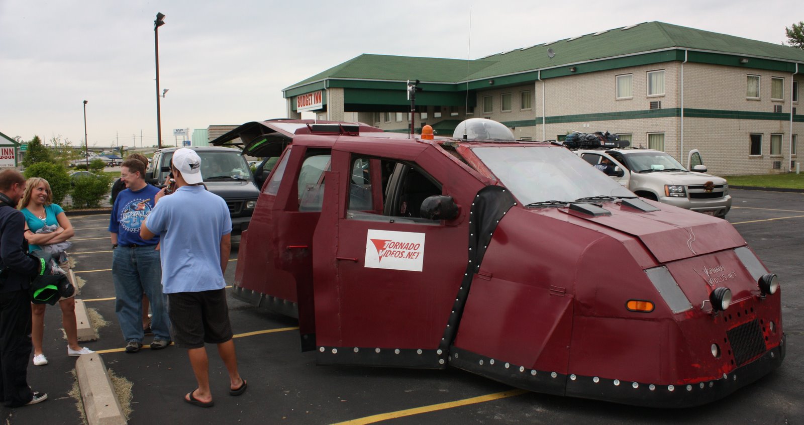
The SRV, by the way, is an armored chase vehicle not to be confused with the TIV from "Storm Chasers", which is easy since it's painted red as opposed to the gray TIV. As we waited in Wentzville for the storms to develop, the whole caravan attracted a lot of attention. Not surprising, considering one of the vehicles was a red tank. The people who came to have a look were from all walks of life - a cadre of law enforcement officials, firefighters, handymen, children, even a woman returning home from surgery. Everybody wanted to have a look, and Reed was happy to show off the SRV to all comers, especially the hydraulic system. This system allows the SRV to drop all the way to the ground, which combined with rubber skirting around the entire base of the vehicle, will (supposedly) prevent wind from getting underneath the truck and tossing it into the air.
 Meanwhile, the sky began to clear, thanks to a large storm that formed to our South and sucked all of the moisture out from Central Missouri. If it weren't for this cell, that moisture would have been drawn into the larger low-pressure system we ended up following and initiated a large-scale severe weather outbreak (one of the largest of the year) that would have spawned dozens of tornadoes and put many more lives at risk. At 2:40, the Storm Prediction Center (SPC) in Norman, OK issued their first tornado watch, covering Northern Missouri & Southern Iowa. By 3:00, the SPC had issued a second tornado watch, this one covering all of Southern Illinois. Things were beginning to happen, but we had to make a decision - which way to go? The first option was the Southern Illinois area, but since the chase terrain was hilly, it wasn't ideal for staying close to the storms. We decided we needed to get North to follow the contour of the low-pressure system, along which supercells were now trying to form out of Kansas, heading northeastward for Upper Missouri and Iowa.
As we drove North, we had one eye on the mobile radar, one eye on the sky, and one eye on the road (apparently we'd picked up a cyclops somewhere along the route). At around 4:00, as we reached the town of Macon, it started happening. The supercells had pushed their way through the cap and were exploding higher than 50,000 feet into the atmosphere. With the smallest window for error, the caravan quickly refuelled at the nearest gas station and used the facilities with a NASCAR-like precision, then jumped back into the chase vehicles, and sped (I mean serious movement here) North to cut off the supercells near Kirksville, Missouri, 35 miles to the North.
Then, the announcement we'd been waiting all day for: Tornado Warnings! First one, then another, then another... All in quick succession, and each more intense and more serious than the last. "Trained storm spotters report funnel cloud." "Tornado reported on the ground." "Large tornado reported." The view out the driver's side windows told the tale - a massive anvil cloud stretched out over most of the sky, high above dark clouds that reached for the ground. Matt Van Every, our guide and driver, turned on the four-way flashers and activated the rear light bar. "Get your game faces on." As we reached downtown Kirksville, the cell directly to our left dropped a wall cloud from its base (a good sign that a funnel cloud is about to form) and we looked to go West toward the quickly developing storm.
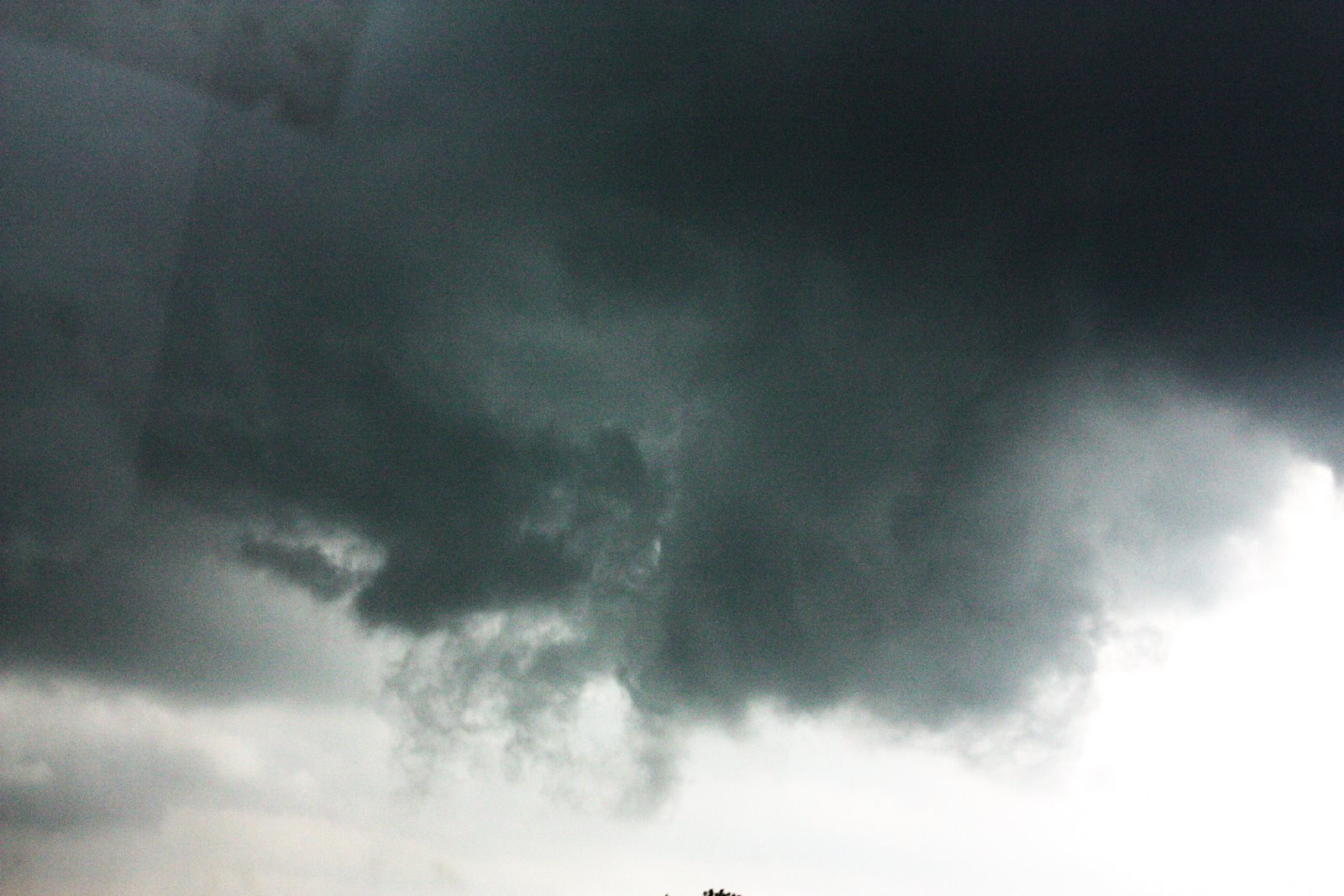 Heading West on Rt. 6, the sky darkened drastically. The wind increased. Leaves began to swirl in the air. The radar showed rapid rotation. The rain pummeled the roof over our heads. Matt slowed the van to a crawl, and pulled to the right shoulder.
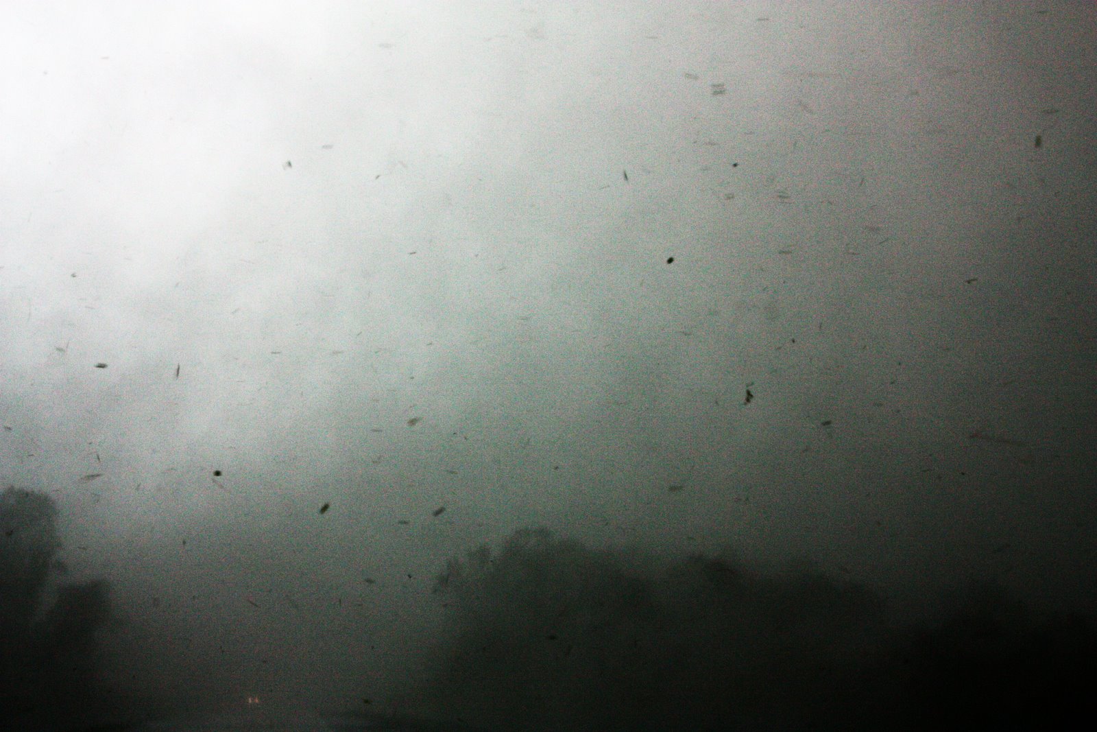
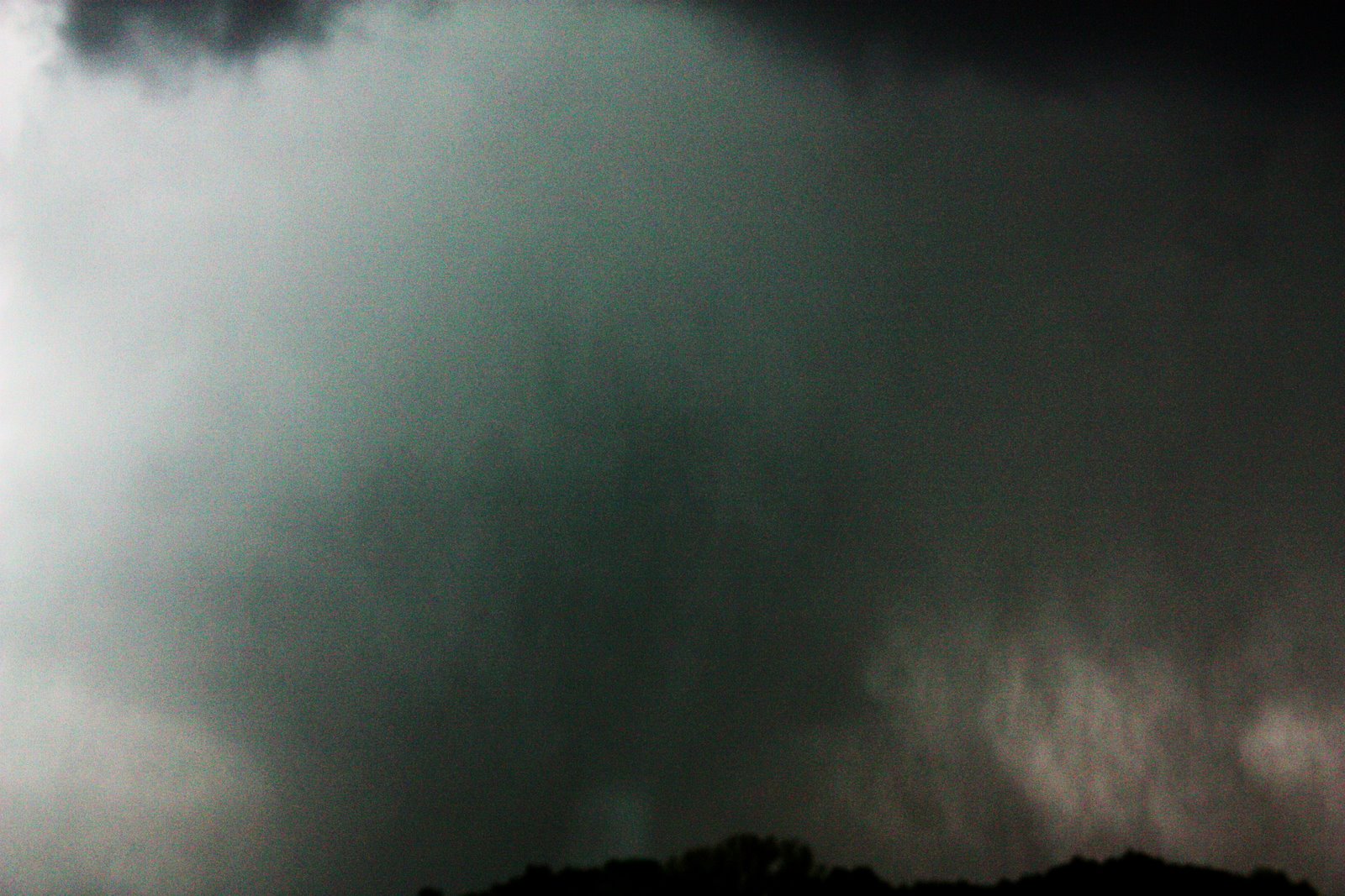
And then a very strange thing happened. The wind abruptly, and violently, changed direction, so that everything around us - leaves, grass, rain, standing water, began to disappear into the trees ahead of us and to the left. Then we noticed that it wasn't just leaves swirling in the air - it was pieces of wood, sheet metal, shingles, insulation... As we crept along the shoulder we rounded a bend, and before us roared the most devastating thing I'd ever laid eyes on. I saw in front of me a roiling mass of debris, rotating at incredible speeds around a dark gray, wedge-shaped blur and now emerging back towards us through the trees. A hundred yards ahead, finally, after a lifetime of dreams and nightmares about this exact moment, I saw a monster tornado erupting towards me.
 What happened next is a chapter unto itself, and I'll continue from here in tomorrow's blog.
posted by Blake at
12:13 AM
![]()

2 Comments:
That is some crazy stuff. Saw the video and that was nuts. Way to go.
That is nuts. I saw the video. Some craziness you shot with the camera. WoW.
Post a Comment
Subscribe to Post Comments [Atom]
<< Home